

I'm a graduate of the Agriculture Diploma Program at the University of Manitoba.(1995)
Since then I've been mostly full time farming except during the winter
and of course flood time! My farm is located just a bit north of
Morris, Manitoba; about 25 miles/50 kilometers south of Winnipeg.
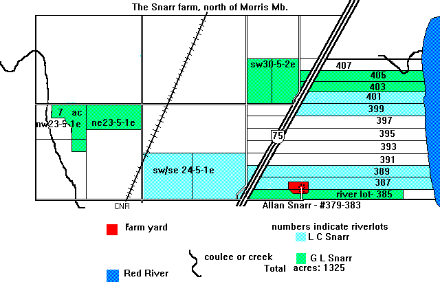
The farm is made up of about 1400 acres of farmland, mostly along the west
bank of the Red River. We have about a mile of riverfront property within
7 river lots. We also have land west and away from the river
adding quite a variety to the farm in soils, crops, etc.
Soil types include Red River clay (gumbo), Ozborne clay (worse gumbo) and
Riverdale silty clay (best gumbo located along the Red River).
Some of the farm is divided into riverlots as well as the regular section
designations. River lots were surveyed when French settlers arrived in
the late 1700's to the mid 1800's.
Crops include most cereal grains, oilseeds (mainly flax and canola) occasional pulse
crops such as Soybeans, as well as various pedigreed seed crops
If you are heading to the United States from Winnipeg (or vice versa) on highway #75 you will be driving right through the farm!

![]()
![]()

![]()
![]()
![]()

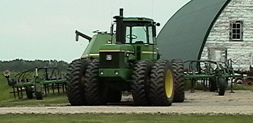
I'm a licensed mechanic in Manitoba and I enjoy working on the usual cars and trucks, as well as larger trucks and farm equipment. I have experience working on most north american vehicles as well as many of the various imports. If you are interested in getting some repairs on your vehicle/equipment give me a call. I'll be glad to help you out!
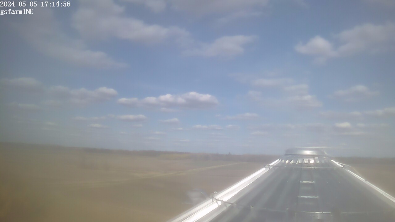
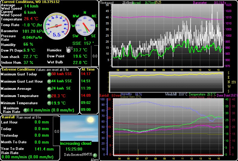
The graphic below updates every 5 minutes. Click on the link below it for the station generated weather report and more graphs & charts.
![]()

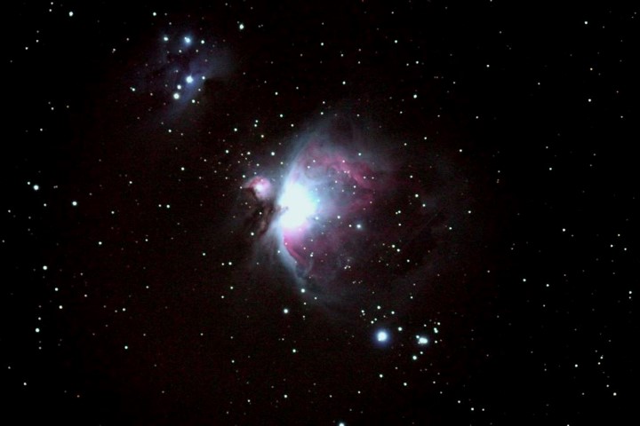
I am a member of the Royal Astronomical Society of Canada (specifically) Winnipeg Centre
Although I am not new to this field of interest, I am looking forward to learning more about it though the RASC members and joining them for Member Nights at the Observatory at Glenlea, monthly meetings, and other events.
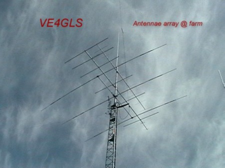
I run an APRS station at home and also have a Kenwood D7AG portable radio and GPS for use as a tracker. Click here too see where I am (ve4gls-14) mobile.
Click here if you want to look up a callsign, or are looking for the callsign of a ham who you know.
NASA Shuttle and ISS Frequencies. The packet radio digi is working very well on the ISS thanks to the flight crew who installed some new antennae and related equipment in and on the Zarya module.
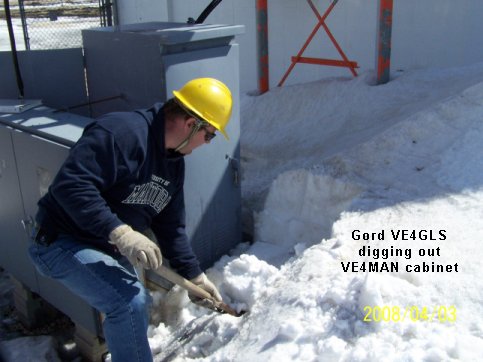
Manitoba ARES was activated in late April of 1997 to provide backup communications in the many communities in Southern Manitoba. Stations were set up in Emerson, Letellier, Dominion City, St Jean, Morris, Rosenort, St Agathe, Sanford, and St Adolphe. Winnipeg ARES helped out with providing operators for the South Centeral ARES operations as well as providing valuable communications for sandbagging inside the City of Winnipeg.
Here's some info on our Morris ARES station during the flood.
I should be adding stuff as time progresses. Look forward to some interesting links!!
This is a satellite picture of Morris and the area surrounding the town. This one takes a while to download. This image was taken during spring flooding in April 2001; note the areas covered by the swollen Red River!


Best viewed on:

I can be reached via email at gsfarm9@gmail.com
::alternate (test) weather pageLast updated November 23/2023, schpellng